|
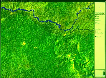
14. Satellite Image 2 No camps are visible now at the merger of the Ituri and Ibina Rivers on the right of the image. However, there were once cross-forest trading routes in the area in the pre-colonial and early colonial days. Now it is entirely covered by the forest, but their traces are recognizable in the satellite image as scattered yellowish-green patches in the forest. In this way, in the Ituri forest, the traces of human activities are left as old secondary forests. There are many useful plants in those places with disturbed vegetation. As such, in the Ituri forest, people utilize plants and animals, while improving, whether intentionally or unintentionally, the conditions for their reproduction. Therefore, it is important for us to understand the history of the interaction between people and forests.
ICHIKAWA Mitsuo |